
AI-Driven Wildfire Detection & Early Warning Systems
Fireball IT is an applied research hub dedicated to reducing emergency response times. We integrate satellite imagery analysis and hilltop camera networks with machine learning to identify smoke and early wildfire signs before they escalate.
Explore Detection Methodologies
Algorithmic Smoke Identification

Smoke behaves like a fluid. It shears in the wind, pools in canyons, and dissipates under high pressure. By training convolutional neural networks on time-lapse imagery rather than static frames, the system learns these specific expansion physics. While our current models achieve high accuracy in daylight, nighttime thermal detection remains highly dependent on atmospheric conditions. The trade-off is processing overhead. Analyzing sequential frames requires heavier edge computing at the camera site, but it drastically reduces the noise sent to emergency dispatchers.
Hilltop Camera Triangulation
A single optical sensor provides a bearing. Two provide a location. Field reporting confirms that isolated cameras often misjudge the distance of a fire by miles due to atmospheric haze or complex terrain masking the base of the plume.
We deployed overlapping fields of view across the ALERT Wildfire network. When a primary sensor detects an anomaly, the system automatically commands adjacent pan-tilt-zoom cameras to intersect the coordinates. This controlled comparison between single-point estimation and multi-point triangulation yields a precise geographic polygon. Dispatchers receive exact coordinates rather than a general vector. The implication is a fundamental shift in initial attack strategy—crews drive directly to the ignition point instead of searching a ridgeline.
Macro-Level Satellite Integration
Ground sensors have blind spots. Geostationary satellites provide continuous continental oversight, identifying thermal anomalies before smoke breaches the forest canopy.

We integrate macro-level orbital data with micro-level ground observations. A satellite detects a sudden thermal spike in a remote wilderness area. The system cross-references this with the nearest hilltop camera, commanding it to verify the anomaly. Edge cases still exist. Heavy cloud cover can mask thermal signatures from orbit, and steep canyon topography occasionally blocks line-of-sight for ground cameras. How we bridge these specific blind spots remains an active area of our research.
Core Research Areas

AI Detection Systems
Machine learning algorithms designed to identify smoke and early wildfire signs.
Explore Research
Camera Networks
Technical specifications for hilltop deployments and the ALERT Wildfire system.
View Deployments
Satellite Monitoring
Global satellite imagery integration for macro-level tracking and prevention.
Analyze DataResearch & Engineering Team

Marcus Hale
AI Detection Systems Strategist

Sophia Lang
Camera Networks Analyst

Kenji Nakamura
Satellite Monitoring Specialist
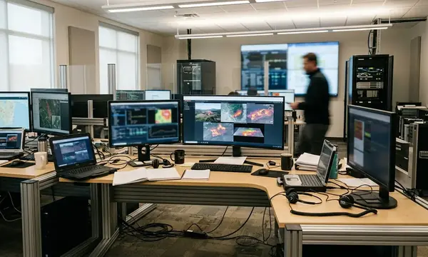
At 14:00 hours in the operations center, a red polygon flashes across the topographic map display. No human called it in. A hilltop sensor twenty miles deep in the national forest caught the first wisps of gray against a blue sky, cross-referenced the thermal data from orbit, and locked the coordinates. The dispatcher keys the radio, routing the nearest air tanker to a fire that is still small enough to extinguish.
Latest Research & Field Reports

Our Scientific Method
Inquiry
Frame the central question and scope.
Evaluate
Assess evidence through systematic review.
Report
Communicate outcomes across the field.